The drive to the Long Bangan longhouse was a bumpy journey that rattled our teeth and spines. It was a balmy Friday in August 2022, and the sun blazed as our four-wheel drive traversed the uneven terrain through the Malaysian state of Sarawak, on the island of Borneo. Michael Jok, an Indigenous activist, halted the car on the way to the longhouse so we could take in the view: a uniform, manicured sea of green palm trees.
It was not a moment of pride. These were oil palm plantations, interspersed with barren patches of land freshly cleared to make way for more trees.
Palm oil production is one of Malaysia’s primary industries. Derived from the fleshy fruit of the oil palm, palm oil is widely used in everyday food products, cosmetics, and consumer goods. Malaysia increased cultivation of oil palms in the 1960s as the government aimed to remove its economic dependence on crops such as rubber. These efforts were successful: In 2020, palm oil constituted nearly 38% of Malaysia’s agricultural output, with the country producing 30% of the world’s total amount of palm oil.
Driving further towards Long Bangan village, we caught sight of containers on the side of the unpaved road, filled with fiery-red oil palm seeds ready to be processed.
This plantation, Jok told Rest of World, is owned by SOP (Sarawak Oil Palms) Borneo Plantations. The company, which has almost 80,000 hectares of plantations between its 33 entities, is a joint venture between the Sarawak state government and other shareholders that include palm oil producer Shin Yang Plantations. Shin Yang is also the sister company of one of the largest timber firms in the state.
Jok was heading to the Long Bangan longhouse to update his community on the final court ruling for a civil case they had been pursuing against SOP (Borneo), Pusaka KTS Forest Plantation, and the Sarawak government. The Long Bangan community says the plantation has expanded beyond its legal boundaries, and encroaches onto land that belongs to them.

Logging and oil palm plantations have clashed with Indigenous land rights in many countries around the world. In Borneo — the world’s third-largest island shared by Brunei, Malaysia, and Indonesia, home to over 50 Indigenous groups — conservation and Indigenous rights groups claim the rapid expansion of oil palm plantations has trespassed on protected forests and land traditionally owned by Indigenous communities. The production of palm oil has also been linked to deforestation, air and water pollution, and a loss of biodiversity. Villagers claim that they’re rarely compensated.
Nonprofit organizations in Borneo are training Indigenous communities to formally establish their native land rights in order to protect their local areas from such encroachment. But first, they need to demarcate which land is theirs. To do so, they are turning to mapping technologies such as GPS and geographic information systems (GIS), and in some cases drone photography, to document their native land. Once it has been sufficiently mapped, they can apply to have their land be legally recognized as protected native land, and fight against illegal intrusions by logging and plantation companies in court. Without that protection, these communities face displacement, destruction of their homes, and a loss of their cultural identity.
In Sarawak, the issue is particularly acute. Malaysia is the second-largest palm oil producer in the world after Indonesia, and Sarawak has more oil palms than any other part of the country. As of December 2022, the state is home to 28.6% of all Malaysian oil palm plantations — 1.6 million hectares, about the size of the Serengeti. In 2022, Sarawak recorded 90 cases of illegal logging, the highest number in the country.
As secretary-general of the Society for Rights of Indigenous People of Sarawak (SCRIPS), Jok — who is of Indigenous Kenyah descent — is deeply involved in local mapping. On the way to the longhouse, he talked about his efforts to document traditional uses of the land by merging oral histories and mapping technologies, and to teach mapping techniques to other Indigenous members in the hopes that they can protect their land.
“It burns our spirit to work harder to help communities create more maps and do more documentation,” Jok said.
As we approached the longhouse, we passed a sign erected by the oil palm company prohibiting construction. “You see,” Jok remarked. “They’re the ones making rules for us.”

Indigenous communities around the world have increasingly turned to mapping technology as a way of proving claims to their land. In Sarawak, oil palm plantations are the top concern, but clashes may arise over logging, mining, agriculture, or construction. Disputes boil down to the same question: Who has the right to use the land?
The United Nations estimates that Indigenous peoples, broadly defined as culturally distinct communities that have a longstanding, historical, and collective ancestral connection to their land and the natural resources on it, occupy 20% of the Earth’s territory. But despite living in an area for generations, Indigenous communities may not have official title deeds. Mapping technology can help formalize their claim to the land.
“We’ve always been spatially grounded in our territories and understanding those places,” Steve DeRoy, founder of Canada’s Indigenous Mapping Collective (IMC), told Rest of World over a video call. “It’s really important that the story gets told through that Indigenous voice. And so, when we train people on how to use these technologies, we’re also providing an opportunity for them to be able to retell the story through an Indigenous lens.”
DeRoy founded the IMC in 2014 to provide Indigenous communities with tools, training, and resources to use mapping technology effectively. The organization works with Indigenous communities across Canada and the world, making maps that reflect their unique cultural, social, and environmental values — a process IMC calls “decolonizing the map.”
A map is a snapshot of the land, at one point in history.”
Many other projects around the world have similar aims. The Native Land project, also in Canada, uses interactive maps to show the traditional territories and languages of Indigenous peoples across the world. In South America, the Amazon Network of Georeferenced Socio-Environmental Information (RAISG) maps the territories and resources of Indigenous peoples in the Amazon basin.
Maps have proven a critical tool in some landmark cases to protect Indigenous land rights. In 2019, for instance, the Waorani people won a legal ruling to prevent the Ecuadorian government from auctioning their land for oil exploration without their consent. As part of their efforts, they mapped 1,800 square kilometres of territory in the Ecuadorian Amazon.
-
An oil palm nursery in Sepakau. -
Workers transfer oil palm fruit to a transport container.


In Malaysia, SCRIPS is joined by several other organizations using mapping tech to protect Indigenous land. Their efforts have advanced along with the technology available to them. The Switzerland-based nonprofit Bruno Manser Fund (BMF), which focuses on forest conservation and protection campaigns in Sarawak, makes regular visits to the region. Baptiste Laville, who works on the foundation’s Sarawak projects, told Rest of World they conduct regular training to help residents collect data in order to pressure the government and logging companies to stop illegal activities. “We started more than 15 years ago, with old-school mapping — with compass, pen, and hand-drawn maps. But the technology is developing very well,” he said over a video call. “Today, we also use satellite images to see logging activities based on colorations. We monitor with camera traps.”
BMF’s next project — about to enter its distribution phase — involves local people collecting data on their phones. The nonprofit has developed an app called Jaga Tanah (Malay for “Protect Land”) where people can report and document observations about forest change and pollution. “The idea of the application is to report on encroachment and logging — data sent straight to the internet for statistics and images.”
By combining these tools, BMF and other organizations hope to collect data on potentially illegal activities in real time, and document evidence that can be used in court to reclaim ownership over land. “[A] map is an instrument of power, it’s a powerful tool,” Laville said.
But, he added, maps alone are not enough; they must be taken in context. “Mapping is a step into something much deeper than a step into the land — into the culture and into the history, and even into some old traditions and spiritual life,” he said. “A map is a snapshot of the land, at one point in history.”
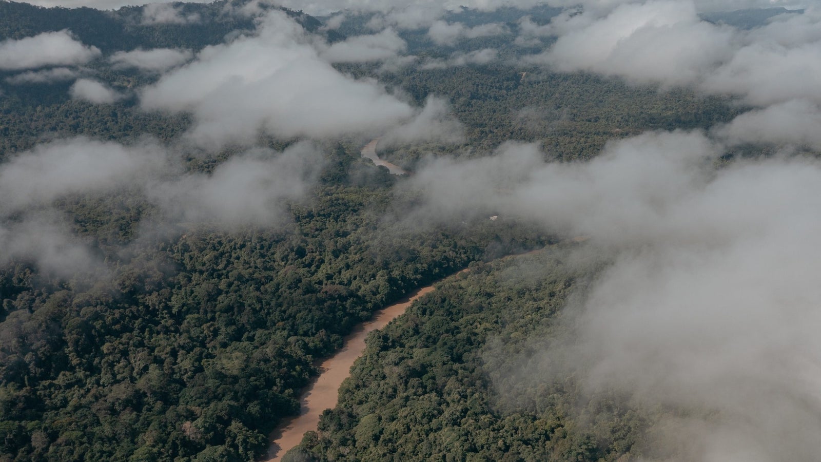
In Malaysia, a legal concept known as native customary rights (NCR) recognizes the collective ownership of land by Indigenous communities even if they don’t have formal deeds. NCR land refers to land that Indigenous peoples have occupied and used for generations, based on their customary practices and traditions known as adat.
Passed down through oral tradition, adat encompasses a wide range of practices, including land use, resource management, social organization, and spiritual beliefs, shaping the ways in which communities govern themselves and their resources. It is essential to understanding Indigenous peoples’ relationship with the land, the environment, and one another. For example, adat may dictate how land is divided and allocated within a community, how water and timber are used and managed, and how social and economic relationships are structured.
The main legislation containing provisions on NCR land in Sarawak is the Sarawak Land Code. However, the limitations of the code, which principally covers farmland or land with built structures, have led to disputes over the ownership and boundaries of NCR land. Activists have accused the state government of amending the code to legitimize land grabs and grant licenses for logging, mining, and plantation activities on NCR land without the communities’ consent.
-
Gebril Atong, an Indigenous community activist, learns how to map with a drone. -
A laptop loads GPS coordinates in Long Bangan.


Residents of the Long Bangan longhouse first launched their case against Sarawak government agencies, Pusaka KTS, and SOP Plantations back in 2010, after attempts at negotiating with the companies went nowhere. Since 2000, they had noticed SOP bulldozers and other machines encroaching on and damaging their land. Members of the longhouse, including Jok, eventually filed a summons, in which they claimed SOP Plantations and Pusaka KTS had encroached or trespassed on their land. Pusaka KTS and several government agencies contacted by Rest of World did not respond to a request for comment. SOP declined a request for an interview.
As the case progressed, maps became important in pursuing their territories. Jok explained that the High Court documents had referred to maps based on aerial photographs of the area taken in 1951, and between 1963 and 1966. The defense team had merely reproduced these photographs and identified 39 plots, instead of conducting their own mapping and investigation. In 2014, the High Court returned 10 out of the 39 disputed plots to the community. The same year, the companies appealed the decision and won. But on July 7, 2021, the federal court ruled that the 10 plots did, in fact, belong to the community and gave them back.
Jok and his fellow activists saw the ruling as a partial victory. They were disappointed that they were only returned 10 of the plots. “Though we’re not happy with the decision, we respect and humbly acknowledge the decision of the court,” he said. “But it doesn’t mean we agree with the decision and proof shown by the land survey.”
For Jok, the case underscored the need to create maps that accurately reflect the on-the-ground reality of Indigenous land rights. “If we don’t take any action, the companies will continue to expand. And when our parents die, nobody will fight for them anymore because the youths don’t know what’s going on,” he said.
To conduct its mapping, SCRIPS first gathers data from local communities through oral history interviews about their land, and by identifying particular landmarks such as rivers, farms, and communal graves. Then, a team treks into the forests with handheld GPS devices to gather coordinates based on those stories. In a meeting that follows, the community decides which elements on the map are important for documentation. The SCRIPS team then uploads these points into the GIS software, which analyzes and integrates location data (such as latitude and longitude) and the descriptions. The result is a visual map that stores and displays a spatial analysis of the location.
As we made the occasional stop during our journey to the longhouse to take photos and observe the land, Jok and his SCRIPS colleague Gebril Atong talked about a new tool they were excited about: drones.
“You can check climate change and de[forestation] or reforestation,” Jok said. “We want to train our community how to use these too.”
“Besides,” he added cheekily, “they can look for their babi (pigs)!”
“If they can play video games, they can surely use drones,” said Atong, laughing.
If they can play video games, they can surely use drones.”
Atong, who is of Punan ethnicity, is responsible for conducting GPS survey work for communities that reach out to SCRIPS. He began learning to survey in late 2008, and purchased a GPS device to document his own NCR land. In 2014, Atong and the other residents of his longhouse at Sungai Punan Ba village sued the state government and several companies for encroachment into their NCR land in Sarawak’s Kapit division. The case has been a long and grueling battle, and Atong is currently awaiting a ruling.
Atong said drones would help with his survey work, allowing him to retrieve more accurate measurements and 3D images without spending hours trekking through the terrain. In March 2022, he was able to purchase a drone after receiving a Malaysian film grant for his short documentary, Baliu Kano Kai (Ancestral Domain of the Punan Ba), on protecting his ancestral land against logging activities.
“This land is what we inherited from our ancestors for hundreds of years,” he said, as he toggled with the drone controls. “How can someone in Kuching [Sarawak’s capital city] tell us we do not have rights to this land?”


After three hours, we reached the Long Bangan longhouse by nightfall. A modern-built complex that houses about 135 families and surrounds a football field, the two-storey longhouse is cemented and tiled. It has a separate unit for each family, connected by a shared veranda. The evening was punctuated with lively beats of dangdut — a genre of local folk music — as villagers gathered to sing and dance.
The following morning, on August 27, 2022, longhouse members met on the veranda to discuss the federal court ruling and why it was important to continue protecting their land. While the ruling had been made in 2021, Covid-19 lockdown restrictions had prevented Jok and his SCRIPS team from visiting sooner. There was an air of excitement as Jok, along with his colleagues Atong and Paul Anyie Raja, a lawyer, gathered the residents. They included young adults who had returned from working in the city to be a part of the discussion. Elderly women sat at the front of the group.
“We need to understand the law, and be proactive in fighting for our land,” said Martha Jangan, headwoman of the longhouse, in a speech. She urged the residents to participate actively in community efforts to ensure their land does not get encroached upon, and to reconsider selling it as it would not be easy for the longhouse in the future to get back relinquished land.
“We should be proud of our customs,” Raja told the crowd. He explained in detail what the case had entailed, starting from when the process began in 2010. The SCRIPS team underlined why it was important for the community to be aware of their rights and pursue encroachment issues even in court. Autonomy over their lands, they said, would ensure livelihood for future generations.
Jok told Rest of World the community does not oppose all development. “We just want to have rights over our own property, ” he said.
Married couple Lirek Huan, 31, and Aaron Ady Jau, 32, told Rest of World they had seen massive changes in the area since around 2000, when the companies began their operations at Long Bangan — from better roads to the expansion of oil palm plantations. We joined the couple in the veranda of their wooden farm hut, known in Kenyah as lepau, where they pointed out various plots of homegrown vegetables, fruit, and palm trees.
-
Martha Jangan, headwoman of the Long Bangan longhouse in Sarawak. -
Lirek Huan, Aaron Ady Jau, and their children, at their wooden farm hut in Long Bangan village. -
Nor Anak Nyawai, a former president of SCRIPS.


Some of the land in the area is owned by SOP, but Huan and Jau decided not to sell theirs. Instead, Jau has been tending to it and selling the palm fruitlets, used for oil extraction, back to SOP plantations for about 12 years now. “A tree can produce up to seven to eight bunches of seeds,” he explained, adding that one tonne can be sold for up to 720 ringgit ($160).
While they have learned the basics of using GPS to map land, Huan said the younger members of the community aren’t as interested in mapping because they haven’t directly seen the impact of the palm oil companies as much as their parents’ generation has.
When you are pushed to the wall, what can you do?”
Both Jau and Huan are focused on ensuring continued control over their farmland. Jau said he wanted to pass the land over to the next generation. He felt it was better to have autonomy over what they grew on their land, while still reaping benefits from the presence of the palm oil company.
“Almost everyone is planting palm trees,” Huan said, shrugging.
A few days after the longhouse gathering, resident Nor Anak Nyawai took me to see his land. An elderly man of Iban ancestry, Nor was involved in a landmark case surrounding land disputes, which showed the critical role community-made maps can play in legal rulings pertaining to NCR land.
In 1999, Nor brought a case against the government and a pulp-and-paper company. It involved the Iban community of Sungai Sekabai village, which claimed that Borneo Pulp and Paper — subleasing from Borneo Pulp Plantation — had trespassed upon and damaged their NCR land.
Nor showed me the land that had become the focus of the dispute. It was an expansive area, surrounded by acacia tree plantations used to make wood pulp. “They say that we lie about our land, because the land is big,” Nor said. “But when you are pushed to the wall, what can you do?”
As we took in the pristine area, itself devoid of acacia trees, Nor recounted how he had almost lost these hectares of land. “No one dared to sue the government, but someone has to do it, before our land gets lost,” he said.
As part of the legal challenge, his community presented maps to the court that showed the extent of their land use, including the location of their farms, graveyards, and other important sites. Ultimately, the High Court of Sabah and Sarawak ruled that the Indigenous people of Sarawak had the right to challenge the validity of land titles granted by the government on their NCR land. The victory was considered a first for NCR lands in Sarawak.
Nor became known as “Bapa NCR” — “Father of NCR Lands” — and was the president of SCRIPS from 2014 to 2016.
His son-in-law, Kerangan Anak Toba, works his own farm nearby, cultivating palm products to sell to the palm oil companies. At 60 years old, Kerangan collects palm seeds daily from his land — also reclaimed through Nor’s efforts. “You’ll know it’s ready to collect when they turn a little red,” he said, as we looked over the 300 trees on his farmland. After half a day’s work with the help of three others, he is able to sell three tonnes worth of seeds.

In his office in the town of Bintulu, approximately 260 kilometers from the longhouse, Raja, the lawyer and SCRIPS member, told me it was necessary to work directly with impacted communities to get this kind of evidence of land use. “Without maps, you can’t even fight for your case,” he said.
Raja is of Kelabit descent, and has been practicing law since 1994. He’s developed a name for himself for taking on cases in defense of the Sarawak people as they struggle to protect their NCR land. “Because the government has at their disposal all the surveyors, the aerial photographs, maybe even records in the district office, you cannot go to court bare-handed,” he said.
But even when Indigenous peoples are ready to go to court, they can face challenges. Lawyers may also receive threats if they take up community cases against big companies.
“Lawyers are scared and not willing to take up cases because they feel that there’s not much money there,” Raja said. “Number two, by being involved with Indigenous peoples’ rights and fighting for their land, many lawyers feel that you might antagonize either the government or the private sector.”
But for him, the work is too important. “I’m a native, and I don’t want to live a life … where you regret not fighting,” he said. “So that’s why I devote most of my practice in this line of business — the legal business fighting for NCR cases.”

Indigenous and land rights advocates in Sarawak have faced threats, and even murder. In 2016, activist Bill Kayong, who had campaigned on issues related to Indigenous peoples’ rights, was shot at a traffic intersection. In 2008, a Penan headman, who had been at the forefront of his community’s case against timber companies in the region, mysteriously died.
When Raja started working on cases like these, senior lawyers warned him off. At one point, he said, someone broke into his office and stole his laptop. “I am scared like anybody would be — but this shouldn’t be a hindrance for us to fight for what is right,” said Raja. “So we still have to forge on.”
Local communities don’t always win their NCR land disputes. In a 2016 case involving Iban communities from two villages, the federal court ruled that there was no force of law to adat claims. In 2019, their application to review the ruling was also dismissed.
“So you see, in the courts, they also have different opinions on NCR land. Some support it, some don’t,” Jok said.

The lack of practical recognition of NCR land, despite being part of Sarawak’s land code, has been a significant obstacle. The government has been slow to implement legislation that would give Indigenous communities greater control over their traditional lands, leaving them to navigate a complex legal landscape and rely on precedents set by previous court cases.
There have also been barriers to how communities can use mapping tools. The Land Surveyor Act, introduced in 1998, sets out guidelines and regulations on the work of land surveyors in Sarawak. But following Nor’s case, the state government passed a bill that mandated all maps be produced only by a surveyor authorized by the Department of Land and Survey, without causing any major damage to the land. Under the new bill, non-professional surveyors could be found guilty of “illegal practice” and punished. Some Indigenous communities claim it represented another tool of oppression, restricting them from easily surveying their own land.
According to the act, land surveyors are required to seek permission from the Board of Land Surveyors before starting any work on NCR land. This permission is often difficult to obtain as it requires navigating bureaucracy and legal proceedings.
As a result, many NCR lands remain unsurveyed and undemarcated, leaving them vulnerable to encroachment and exploitation. This has led to numerous land disputes and conflicts between Indigenous communities and developers, often resulting in violence and displacement.
“We become ‘illegal settlers.’ We become foreigners in our own land,” Jok said.
Despite the challenges, there are those who are working around the act.
We become ‘illegal settlers.’ We become foreigners in our own land.”
“When the law came out, the government wanted to shut us down,” Mark Bujang, an independent surveyor involved in Nor’s case, told Rest of World. “But once we went through it and consulted a few lawyers, they said that it only applies to [mappers] who want to apply for a [land] title. You can still create your own maps. It’s only when you apply for a land title that you need a license.”
The recognition of community maps differs by country. On the Indonesian side of Borneo, a government-led initiative called the One Map Policy (OMP) aims to integrate all spatial data into a single, authoritative map. The policy is geared at addressing conflicts over land use, particularly between Indigenous communities and the government or private companies.
But Kartika Sari, chairperson of Palangkaraya Ecological and Human Rights Studies (PROGRESS) in Kalimantan, the Indonesian part of Borneo, told Rest of World the OMP may not entirely solve the issue, as such maps require official documentation. “Most of the Indigenous peoples do not have official documents, because these are ancestral lands passed down,” she said. “This is what ends up becoming an issue — because the adat of the community is not yet acknowledged and protected.”
“Maps do not always solve the problem — it’s how the maps are being used,” said Sari.

In late August 2022, Jok invited me to a SCRIPS workshop in Bintulu, one of many conducted by the organization to introduce local communities to mapping technologies.
After leading a round of prayers in the hotel’s conference room, Jok strode purposefully to his laptop and splashed a Google Earth map of Bintulu on the projector screen.
Watching him was a group of 26 eager adult learners, in their 20s to their 60s, from various Indigenous groups. They huddled over their laptops, tapping on tiny handheld devices slightly larger than their phones — GPS trackers.
The room burst into a chatter of excitement as they began exchanging pointers on operating the device, such as how to enter and read coordinates.
Jok and another SCRIPS volunteer, James Guntor, talked about how to use GPS to determine NCR land and settle land disputes with neighbors. He gave them a brief overview of how GPS trackers can be used to gather community data, both for village-planning and as potential court evidence to claim land ownership. He then led participants out of the room to plot GPS coordinates using the devices. Back in the conference room, they viewed the plotted points on their laptops.
-
Jok speaks to the room during the SCRIPS workshop. -
Workshop participants practice with GPS devices.


“Our land is our livelihood,” Jok told the room. “So as Indigenous peoples, we must tend to it with care.”
Sylvester Gerunsen Jon, a 57-year-old from the Tinting Mawang Manis Nanga Pila village in Kapit, said it was his first time using a GPS device. As the headman of his village, he said mapping was important for conflict resolutions in his area. “This is a common issue in our kampung [village]. Because from generation to generation, many of us do not know where our territory begins and ends. This issue still continues to emerge from time to time,” he said.
For 26-year-old Alice Joice, who is from the Kenyah and Seping communities, knowing how to plot and measure land using GPS was important to ensure a sense of home, heritage, and belonging. She was the only young woman who attended the workshop. “Because I’m a youth, I need to know,” Joice said. “GPS helps us ensure whose land belongs to whom.”
“It’s only when people are affected that we become conscious and learn about it,” said another participant, Matu Anak Anyau, who had attended several of SCRIPS’ workshops on documentation and mapping. The 45-year-old from Kampung Sebauh is of Iban ancestry. He works in the palm oil industry, and said that people needed to better equip themselves with mapping skills so they could protect their land before it was too late.
“Belum kena, belum tahu,’” he said, shrugging, as he quoted a cautionary Malay saying — “If you’ve never been affected, you’ll never know.”
“Before this, people would simply refer to ‘that hill’ or ‘that river.’ The use of GPS is more accepted in court cases or among conflicting claims among villagers, developers, or the government,” he said. “At least I can help my community if we ever face that — with my understanding, knowledge, and experience of mapping.”