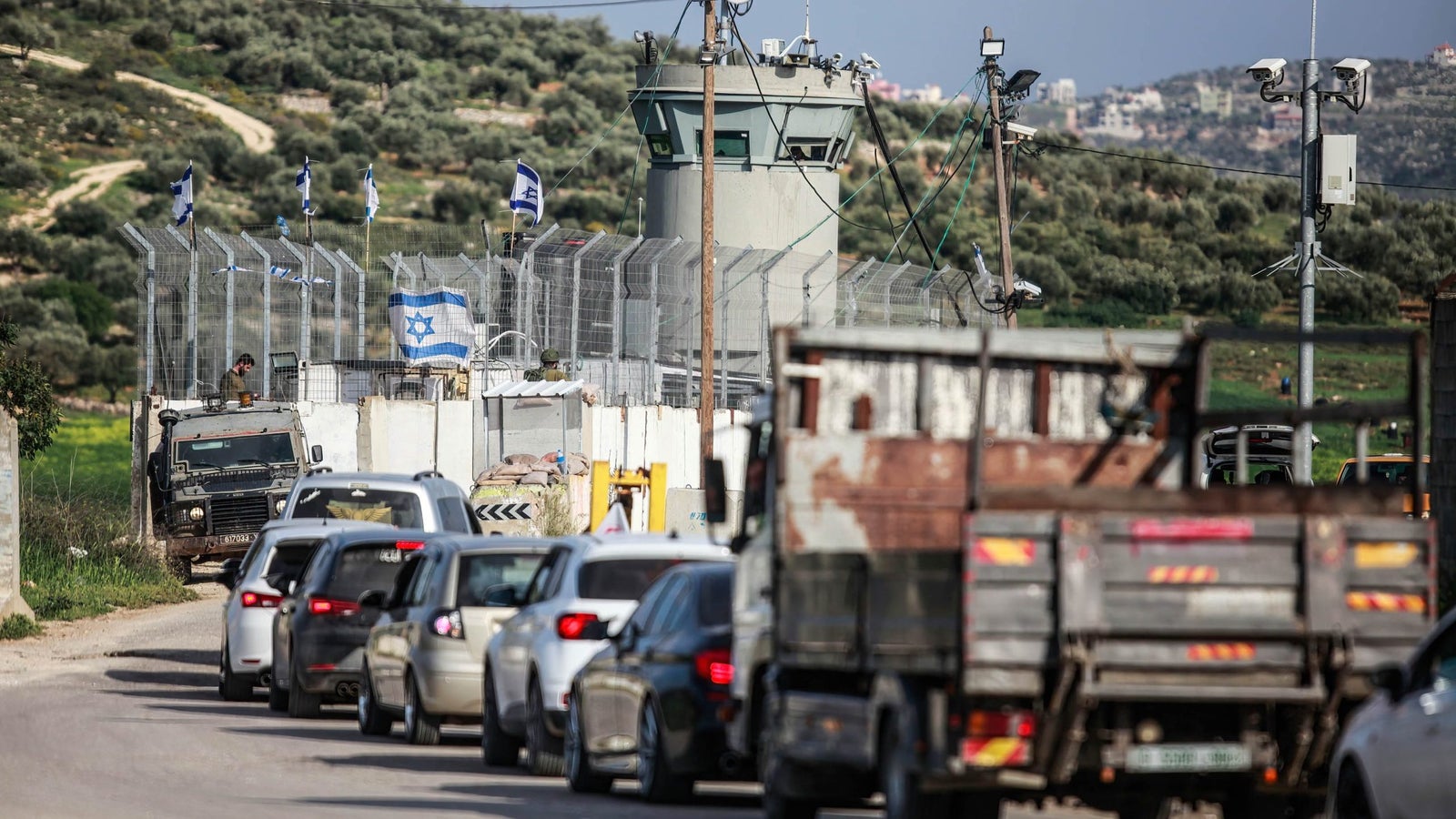
For Palestinians living in the West Bank, stepping onto the roads of the territory occupied by Israel is a daily journey of resilience.
With movement shackled by a complex web of Israeli checkpoints and barriers, homegrown mapping solutions have become their lifelines. These digital networks help Palestinians reach work, schools, and hospitals as blockades have continued to increase since the latest Israel-Gaza war started in October 2023.
Apps such as Doroob Navigator and Azmeh, which crowdsource traffic data and information about road closures, guide them through the numerous obstacles they face in their commutes. The situation has worsened dramatically in recent months. Simple trips that once took 45 minutes now stretch beyond three hours, with some routes completely sealed, commuters say.
Before the war, the UN counted about 565 obstacles across the West Bank. Today, the app Azmeh, Arabic for traffic jams, tracks more than 800 checkpoints and barriers based on updates from its 60,000-plus users, one of the developers of the app told Rest of World on condition of anonymity, fearing Israeli reprisal. In October and November of 2023, 8,000 Palestinians installed the Azmeh app every single day, the person said.
Started in 2015, Azmeh was paused after its creators received threats from the Israeli military, which perceived tracking checkpoints as a security threat. Back online since March 2023, it now has 70,000 users.

“We are stranded for hours, sometimes from sunrise to sunset,” Rakan Said, a minibus driver with 20 years of experience, told Rest of World. “Passengers can’t reach jobs, and drivers lose their entire day’s wages waiting at checkpoints.”
The West Bank’s fragmented road system imposes severe movement restrictions on Palestinians. Approximately 79 kilometers of roads connecting Israeli settlements to each other and to Israel are designated exclusively for Israeli citizens. Palestinians are banned from these roads, and unauthorized entry risks arrest, expensive fines, or violence.
“I use Waze for external roads to check if there’s traffic or the presence of Israeli police,” Abu Ahmad, a minibus driver in Ramallah, told Rest of World. “Waze treats us as Israelis, and as soon as we enter the West Bank, it starts sending warnings that we are in dangerous areas. So, we turn to WhatsApp groups instead.”
We are stranded for hours, sometimes from sunrise to sunset.”
Doroob Navigator, which has more than 200,000 active users, was created by Palestinian tech entrepreneur Mohammad Abdel Haleem when a drive using Google Maps between the West Bank cities of Bethlehem and Ramallah left him lost in a remote valley.
“The app is intended to help drivers by using widely recognized street and place names, offering an alternative to typical mapping tools,” Haleem told Rest of World.
What makes Palestinian navigation networks different from regular GPS systems is that they’re built on community support rather than business interests. While normal navigation apps try to find the fastest route, Palestinian digital networks focus on avoiding risks.

“This is a collective effort to save lives,” Mohamed Atiyat, a minibus driver who participates in and manages WhatsApp groups where thousands share real-time road updates, told Rest of World. “We share minute-by-minute updates on road conditions through videos, voice notes, and text messages so we can help each other stay safe.”
Atiyat’s experience shows what’s at stake — he once spent 36 hours trying to find a route to the hospital for a young cancer patient after the town of Al-Auja was sealed off.
OpenStreetMap (OSM), a collaborative, open-source mapping platform, allows communities to document and update local geographical situations. It allows Palestinians to accurately represent their villages, roads, and barriers that might otherwise be misrepresented or entirely absent on regular navigation tools such as Google Maps and Waze.
This is a collective effort to save lives. We share minute-by-minute updates on road conditions so we can help each other stay safe.”
Palestinians have a long tradition of building community support systems. During the Intifadas — mass Palestinian uprisings against Israeli occupation during 1987–1993 and 2000–2005 — neighborhoods organized committees to distribute food, run schools, and provide healthcare when normal life was disrupted. Today’s tech solutions serve a similar purpose, Atiyat said.

In 2018, Palestinian digital rights group 7amleh started a campaign calling for Google to recognize Palestine on its maps.
“We had been talking with Google’s human rights unit about their responsibilities,” Nadim Nashif, 7amleh’s director, told Rest of World. “Unfortunately, their policies have only gotten worse.”
The navigation efforts face other technical challenges, Maysa Monayer, director general at the Palestinian Ministry of Telecommunications, told Rest of World.
In the region, 3G service is patchy, and frequent GPS jamming disrupts navigation apps, vehicle tracking, and emergency services. The combination of inadequate infrastructure and surveillance makes locally developed alternatives the natural choice.
Clashes with Israeli settlers, who built communities on land captured by Israel during the 1967 war, pose additional risks. UN monitors counted 1,700 settler attacks in the West Bank between October 2023 and December 2024 — about four incidents a day. To avoid the risk, drivers, including Atiyat, have started traveling in groups.
“When we’re just one car on the road, we’re more vulnerable,” Atiyat said. “But with three cars or more, settlers are afraid to attack.”